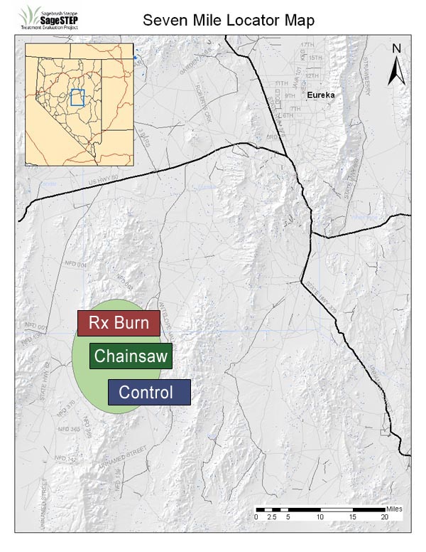
Seven Mile
Seven Mile Site
| Location: | Eureka and Nye Counties, ~40 miles from Eureka, NV |
| Land Management Agency: | USDA Forest Service, Humboldt-Toiyabe National Forest, Austin-Tonopah Ranger District (burn and control plots); Bureau of Land Management, Battle Mountain District Field Office (mechanical plot) |
| SageSTEP Site Manager: | Maggie Gray |
| Plots: | Three 40-acre core plots (Control, Burn, Mechanical); two 1050-acre extensive plots (Control and Burn) |
| Elevation: | 7200-7900 ft |
| Topography: | 6-15% slopes and varying aspect |
| Common Vegetation: | Utah juniper, singleleaf pinyon pine, Wyoming big sagebrush, green rabbitbrush, bluebunch wheatgrass, Sandberg bluegrass, Indian ricegrass, needleandthread, Nevada needlegrass, long-leaf phlox, mat buckwheat, cushion buckwheat |
| Soils: | Loamy-skeletal, loamy, and clayey-skeletal, mixed, frigid |
| Fire Regime: | Historical fire return interval of 30-40 years. Woodland invasion and canopy closure have significantly increased the risk of less frequent, catastrophic fire in these communities. |
| Representative Land Base: | Vast acreages in both the High Central and High Calcareous Provinces |
| Grazing: | Mechanical and prescribed fire plots are located within active grazing allottments and will be fenced for duration of the study; Control plot is not grazed and is unfenced. |
| Treatments Implemented: | Fall 2007 except for extensive plots, which are planned for fall 2008. For more information about treatments, click here. |
Updated 2009
Seven Mile subplot progress images
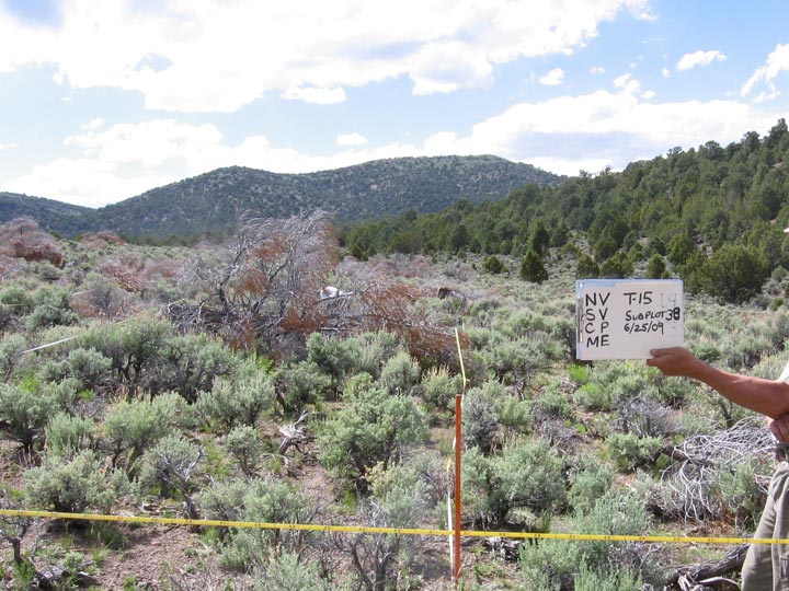
Pinyon-Juniper Woodland Prescribed Burn Subplot
Seven Mile Site Yearly Photo Sequence
Prescribed burns were implemented at all of the SateSTEP woodland study sites. This treatment was used to help increase understanding of the relationship between plant communities, invasive species and fires. The Seven Mile burn took place in the fall of 2007 after baseline data were collected.The images below show one of the prescribed burn subplots at the Seven Mile site from 2007 to 2010.

2007 – Pre-treatment

2008 – 1 Year Post-treatment
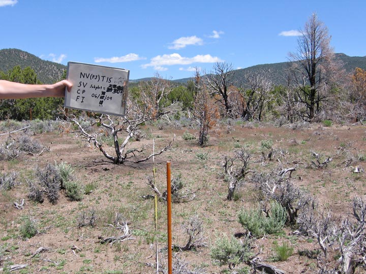
2009 – 2 Years Post-treatment
2010 – 3 Years Post-treatment
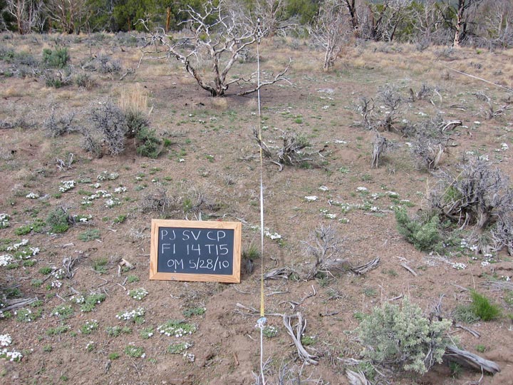
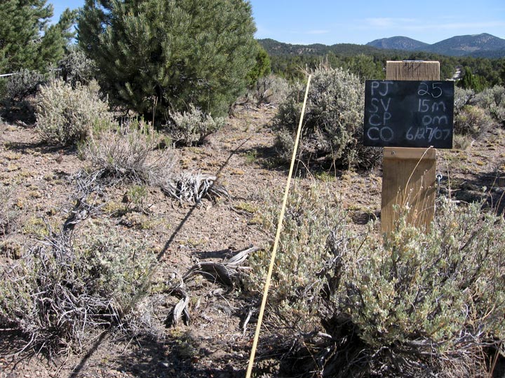
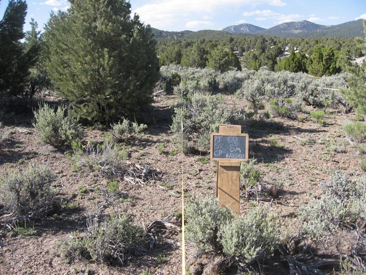
Pinyon-Juniper Woodland Chainsaw Cut Subplot
Seven Mile Site Yearly Photo Sequence
The chainsaw cut treatment was implemented at all SageSTEP woodland sites. All trees over 1/2-meter tall were cut with a chainsaw and left where they fell. The images below show one of the chainsaw subplots at the Seven Mile site from 2007 to 2010. The chainsaw cut took place at Seven Mile in the fall of 2007 after baseline data were collected.

2007 – Pre-treatment
2008 – 1 Year Post-treatment
2009 – 2 Years Post-treatment
2010 – 3 Years Post-treatment
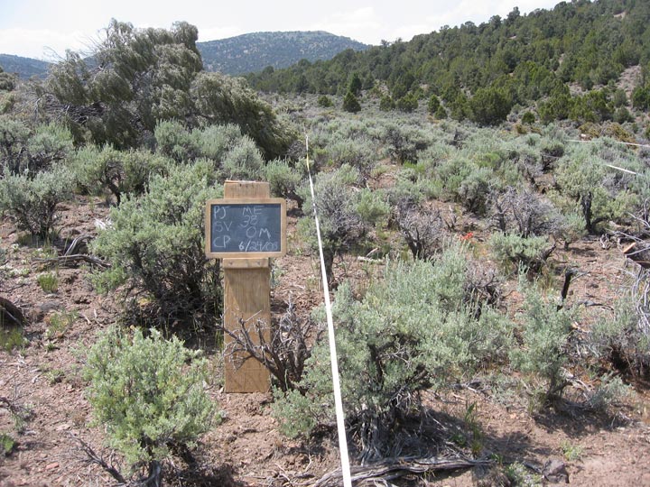
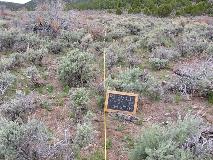
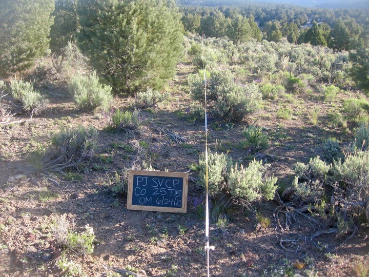
Pinyon-Juniper Woodland Control Subplot
Seven Mile Site Yearly Photo Sequence
All of the SageSTEP study sites have a control plot to account for variations that are not related to treatment, such as yearly climatic variation. The images below show one of the subplots in the Seven Mile control plot from 2006 to 2011.
2007
2008

2009
2010
2011
Contact
Lisa Ellsworth
Project Co-coordinator
Dpt. Fisheries & Wildlife
Oregon State University
Corvallis, OR 97330
Email
(541) 737-0008
Beth Newingham
Project Co-coordinator
GB Rangelands Research
USDA Ag. Res. Service
Reno, NV 89512
Email
(775) 784-6057 ext. 233
Lael Gilbert
Outreach Coordinator
Utah State University
5215 Old Main Hill
Logan, Utah 84322-5215
Email
(435) 797-8455
Site Designed by Kite Media